Preface
South America is, to my mind, "the Coming Continent"—the Continent of the future. Everybody knows the wealth of the Argentine, Peru, Chile, and Bolivia; but the interior of Brazil, the largest and richest country of all, not unlike forbidden Tibet, was perhaps better known a century or two ago than now. Few people realize that Brazil is larger than the United States of North America, Germany, Portugal, and a few other countries taken together. The interior is practically a terra incognita—although the ancient Jesuits and, at a later date, escaped slaves and native rubber collectors have perhaps found their way inland to a considerable distance.
When I started on the transcontinental journey I did not take Europeans with me. It is not easy to find men who can stand the strain of so long a journey. I was also not surprised, although I was disappointed, not to be able to obtain suitable officers in Brazil to go part of the journey with me, so that I might be relieved of a portion of the tedious scientific work of the expedition, especially taking and computing daily astronomical observations, to which much time has to be devoted. All the work of all kinds eventually fell upon my shoulders, and after departing I found[vi] myself filling the posts of surveyor, hydrographer, cartographer, geologist, meteorologist, anthropologist, botanist, doctor, veterinary surgeon, painter, photographer, boat-builder, guide, navigator, etc. The muleteers who accompanied me—only six, all counted—were of little help to me—perhaps the reverse. So that, considering all the adventures and misfortunes we had, I am sure the reader, after perusing this book, will wonder that we got back at all, and will be indulgent enough to give me a little credit for saving, through innumerable disasters—and perhaps not altogether by mere luck—all my photographs (800 of them), all my note-books, all my scientific observations, as well as all the vocabularies I made of the various Indian languages of tribes found on my way. Also for bringing all my men out alive.
Here are, briefly, a few results of the expedition:—
(a) First of all it has proved that, far from South America's being an impenetrable continent—as was believed—it is possible for any experienced traveller to cross Brazil in any direction, if he could obtain suitable followers.
(b) It has proved that the "millions of savage Indians" supposed to be swarming all over the interior of Brazil do not exist at all. All the pure Indians of Central Brazil taken together may number a few hundreds, or including half-castes (negroes and Portuguese), a few thousands. As for the wild beasts and snakes, no one ever need fear being troubled by them. They are more afraid of you than you of them, you can take my word for it. So that the terror which has so far prevented people penetrating the interior has no[vii] reasonable ground, and this book ought to be the means of making European people some day swarm to develop that marvellous land now absolutely uninhabited.
(c) Meteorological observations were recorded daily right across Brazil.
(d) Altitude observations, forming a complete chain and including all minor undulations, were registered across the entire South American continent from the Atlantic coast at Rio de Janeiro as far as Callao on the Pacific coast. The observations were taken with a hypsometer and several excellent aneroids. These show that many of the elevations marked on the existing maps of Brazil are inaccurate, the error amounting sometimes to several hundred feet.
(e) A complete survey was made of new country between the Araguaya river and the Madeira, including a careful survey of the Arinos river and the river Arinos-Juruena, one of the most powerful tributaries of the Amazon. In the small map, reproduced from the best existing maps, at the end of the first volume, several high mountain ranges, quite as high as the Andes, may be noticed extending from north to south between the rivers Madeira, Tapajoz, Xingu, Araguaya and Tocantins. Those high ranges are merely the work of imaginative cartographers, who have drawn them to make the map look pretty. They do not exist. I have left them in order to draw the attention of the reader to them. The position of the Arinos-Juruena is from 1 to 1½ degrees farther west than it is there drawn, and should be where I have marked the red line of my route.
(f) Everything that was of interest pictorially,[viii] geologically, botanically, or anthropologically was photographed or sketched. Astronomical observations were constantly taken to determine the positions of our camps and places of importance.
Botanical and geological collections were made, but unfortunately had to be abandoned.
(g) During the journey the head waters of the following important rivers were visited: The Rio Vermelho, Rio Claro, Rio Araguaya, Rio Barreiros, Rio das Mortes, Rio S. Lourenço, the Cuyaba river, the Xingu, the Paranatinga, the Paraguay river (Paraná), the Rio Arinos, the Secundury.
(h) The entire course of the river Tapajoz was studied, and also the entire course of the Amazon from its mouth almost to its birthplace in the Andes.
(i) Useful vocabularies were drawn up of the following Indian languages: Bororo, Apiacar, Mundurucu, Campas or Antis.
(k) The expedition has furthermore shown that it is possible with poor material in the way of followers to accomplish work of unusual difficulty.
(l) That it is possible for people in a normal condition of health to go at least sixteen days without food while doing hard work.
(m) That it is possible to cross an entire continent—for one entire year—in the company of dangerous and lazy criminals without any weapon for protection—not even a penknife—and to bring forth from such poor material remarkable qualities of endurance, courage, and almost superhuman energy.
(n) Last, but not least, on that expedition I was able to collect further evidence that a theory I had long[ix] held as to the present shape of the earth was correct. I had never believed in the well-known theory that a continent, now submerged, once existed between America, Europe and Africa—in other words, where the Atlantic Ocean is now. That theory has found many followers. In support of it one is told that such islands as Madeira, the Canaries, the Azores, are the topmost peaks of a now partly submerged range of mountains which once stood upon that vanished continent. It is also a common belief that Northern Africa underwent the contrary process, and was pushed up from under the sea. That is why—it is said—the Sahara Desert, which was formerly, without doubt, an ocean bed, is now dry and above water.
One has only to look at any map of the entire world to see what really happened to the earth in days long gone by. Let me first of all tell you that there never existed a continent between Africa and South America. In fact, I doubt whether there is as much as a square mile between those two continents more submerged to-day than it was thousands upon thousands of years ago.
Here is what really happened. The earth at one period changed its shape—when, is merely guesswork, and is of no consequence here—and the crust of the earth—not the core, mind you—split into two great gaps from Pole to Pole, with a number of other minor fissures. In other words, the earth opened just like the skin of an over-heated baked apple. The African and American continents, as well as Australasia, with New Guinea, the Celebes Islands, the Philippine Archipelago and China, which before that event formed part[x] of one immense continent, thus became divided, leaving North and South America isolated, between the two great Oceans—the Atlantic and the Pacific—which were then, and only then, formed.
It is easy, by looking intelligently at a map, to reconstruct the former shape of the world. You will notice that the most western portion of Africa fits exactly into the gap between North and South America, while the entire African coast between Dahomey and the Cape Colony fits in perfectly in all its indentations and projections into the coast line of South America. The shores of Western Europe in those days were joined to North America, and find to-day their almost parallel and well-fitting coast line on the east coast of the United States and Canada. On the opposite side of the world, the western side of South America, the same conditions can be noticed, although the division of the two continents (America and Asia) is there much wider. Fragments were formed, leaving innumerable islands scattered in the Pacific Ocean, half-way between the actual continents of Asia, Australia and America. A mere glance is sufficient to see how well Australia fits in along the Chilian and Peruvian coast, the great island of New Guinea along part of Peru and Ecuador, and the west coast of the Central American Isthmus. The Philippine Islands lay probably in those days alongside of Guatemala, while California bordered on Japan.
Such immense rivers as the Amazon, and its portentous tributaries flowing from south to north, were also formed perhaps at that time, great fissures caused by the sudden splitting and cooling of the earth's[xi] crust becoming the river beds. So perhaps was formed the giant cañon of Colorado and the immense fissures in the earth's crust that occur in Central Asia, in Central Africa, and, as we shall see, on the central plateau of Brazil.
Undoubtedly the Antarctic continent was once joined to South America, Australia and Africa. During the last Antarctic expeditions it has been shown that the same geological formation exists in South America as in the Antarctic plateau. On perusing this book, the reader will be struck by the wonderful resemblance between the Indians of South America, the Malay races of Asia, and the tribes of Polynesia. I maintain that they not only resemble each other, but are actually the same people in different stages of development, and naturally influenced to a certain extent by climatic and other local conditions. Those people did not come there, as has been supposed, by marching up the entire Asiatic coast, crossing over the Behring Straits and then down the American coast, nor by means of any other migration. No, indeed; it is not they who have moved, but it is the country under them which has shifted and separated them, leaving members of the same race thousands of miles apart.
I was able to notice among the Indians of Central Brazil many words of Malay origin, others closely resembling words of languages current among tribes of the Philippine Islands. The anthropometric measurements which I took of South American Indians corresponded almost exactly with those of natives of the Sulu Archipelago and the island of Mindanao.
I hope some day to use the wealth of material I[xii] have collected among innumerable tribes on the Asiatic coast, on the islands of the Pacific Ocean, in South America and in Africa, in making a comparative study of those peoples. It should prove interesting enough. I have no space here to go deeply into the subject, as this is merely a book descriptive of South America. I may add that the most ardent supporter of the above theory is the celebrated explorer and scientist, Colonel Marchand, of Fashoda fame—a man who has studied and understands the mysteries of this world better than any man living.
My sincere thanks are due to the following gentlemen for much politeness shown me in connection with the expedition: To Mr. Gustave Babin, the famous writer of Paris; to Mr. Manoel Bomfin (ex-deputy of Brazil), to Senador Alcindo Guanabara, for the keen interest taken in the expedition and for proposing to Congress after my return that a grant of £4,000 should be given to me as a reward for the work done. I herewith also express my gratitude to the Brazilian Government for paying me that sum, which came in usefully to defray part of the expenses of the expedition. To H.E. Dr. Pedro de Toledo, Minister of Agriculture, for the intelligent desire shown to help as much as he could in the venture, and for kindly giving me the free use of all the telegraphs in Brazil, including the Amazon Cable, and other important privileges; to Dr. José Carlos Rodriguez for hospitality and much valuable advice; to Dr. Paolo de Frontin, Conseilheiro Antonio Prado, Dr. José Pereira Rebonças and Mr. Mockill and their respective Companies for the many privileges granted me upon the various railways of which they[xiii] were the Presidents; to Colonel R. E. Brazil and Commandante Macedo for their kind hospitality to me while navigating the lower Tapajoz river; to Dr. A. B. Leguia, President of the Peruvian Republic; to the British Ministers at Petropolis, Lima, La Paz, and Buenos Ayres, and the British Consuls of Rio de Janeiro, Pará, Manaos, Iquitos, Antofogasta, Valparaiso; finally to the British and American Residents at all those places for much exquisite hospitality offered me.
Special thanks are due to Mr. Regis de Oliveira, ex-Brazilian Minister in London, for valuable credentials given me before my departure which paved the way to the hearty reception I received everywhere in Brazil.
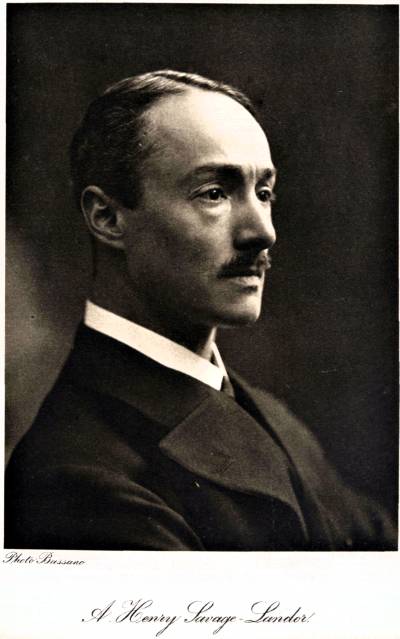
A. Henry Savage-Landor.
Savoy Hotel, London.
September 1913.
Nota de Lisarda- Arnold Walter Savage Landor,


No hay comentarios:
Publicar un comentario